The ancient city of Copan is one of the few larger archeological sites of the Maya civilization in western Honduras. Located near the border with present-day Guatemala, the City of Copan was the capital of a powerful Maya Kingdom spanning back from the fifth to the ninth centuries AD. Located in the extreme southeast of the wider Mesoamerican cultural region, the complex was surrounded by settlements belonging to non-Maya cultures. Although we refer to the ancient city as Copan today, its original name was probably Oxwitik, meaning the Three Witikis.”
The city itself is of great historical importance, and archaeological survey of Copan have revealed the site was occupied from more than 2,000 years dating from the Early Preclassic to the Postclassic period, during which the ancient city developed a plethora of distinct architectural and sculptural styles of expressive Maya tradition.

Archaeological surveys of the ancient site have revealed that the ancient city was home to more than 20,000 people during its peak. The city was by no means little; archaeologists have revealed that Copan covered an area of more than 250 square kilometers (100 sq mi). As revealed by Sharer and Traxler (2006) the central parts of Copan had a density of 1,449 structures per square kilometers (3,750/sq mi) while greater Copan as a whole had a density of 143 per square kilometer (370/sq mi) over a surveyed area of 24.6 square kilometers (9.5 sq mi).
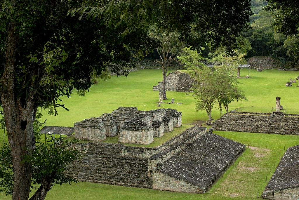
The site is one of the greater architectural sites of the Maya in Central America. Copan is famous for its massive acropolis which is home to a massive complex of overlapping step pyramids, numerous plazas, temples, and palaces, but also for its portrait stelae, many of which were built along with processional ways in the ancient city’s central plaza. Like many other Maya cities. Copan too had a massive court for the Mesoamerican ballgame.

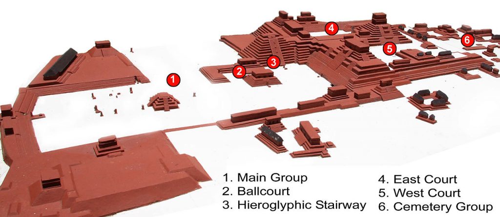
As seen in the above map, the main group represents the very core of the city, covering an area 600 meters by 300 meters. The Acropolis was Copan’s royal complex at the core of the city consisting of two plazas that were dubbed the Western and Easter Courts. These are enclosed by various elevated structures.
Archaeological excavations at the site have resulted in the discovery of extensive labyrinths and tunnels beneath Copan’s royal Acropolis. These bear evidence of how the heart of the city was developed over time. Archaeologists have excavated numerous hieroglyphic texts dating back to the Early classic.
One of the most notorious structure at Copan is the so-called Temple 16 which is a pyramid and the highest structure part of the Acropolis. The pyramid was built between the East and West court, at the heart of the city. This pyramid temple faces the Western Court and is believed to have been dedicated in honor of K’inich Yax K’uk’ Mo’, the dynastic founder. This pyramid was built atop the original palace and tom of the king.
Several groups of buildings have been designated by archeologists. The Main group, as noted above, is the city’s core with the Royal Acropolis being the main feature. In addition to the pyramid (Temple 16), there are other structures. Archeologists have also designated the Sepulturas group which is linked by a causeway that runs southwest to the Monument plaza in the main group. These were mostly residential structures of the elite, tombs and carved decorations. The site is also home to the so-called North Group which is a compound dating back from the Late Classic and the cemetery group, located south of the Main Group and includes several smaller structures and plazas.

